Another nice sunny summer day. A little cooler start than most which was nice. Probably 50 at the start of the day which was 8:00AM at the St. Huberts parking lot. Went up the road to the second sign pointing toward Colvin. Not to far into the woods there was a sign for Indian Head. Ken quickly took this path knowing it would not be possible to talk the group into a detour at the end of the day. Sue quickly started talking about the possibility of retribution if the view wasn't worthy of the extra effort. Removing fingers were mentioned several times. After a few false Indian Head's, where the number of fingers to be removed increased, we got to Indian Head. A very nice view from cliffs that overlook Ausable Lake. You could see the upper and lower lakes and also Colvin. Everyone agreed Indian Head was a very nice spot and Ken was allowed to move on unharmed. The trail down from Indian Head appeared to be a steep downhill which would not be good since we would have to make up this altitude again later. Luckily once we started down the steep trail Bruce and Ken noticed that it was pretty much flat.
The trail up to Colvin was fairly long and got steep as it got near Colvin. There were a few rock scrambles near the Colvin summit that were tricky. Bruce had to be used as a human ladder at one point. This worked well except for the cut on Bruce's head but everyone agreed that wasn't a problem. There was talk of installing ladder rungs on Bruce's back for the next outing.
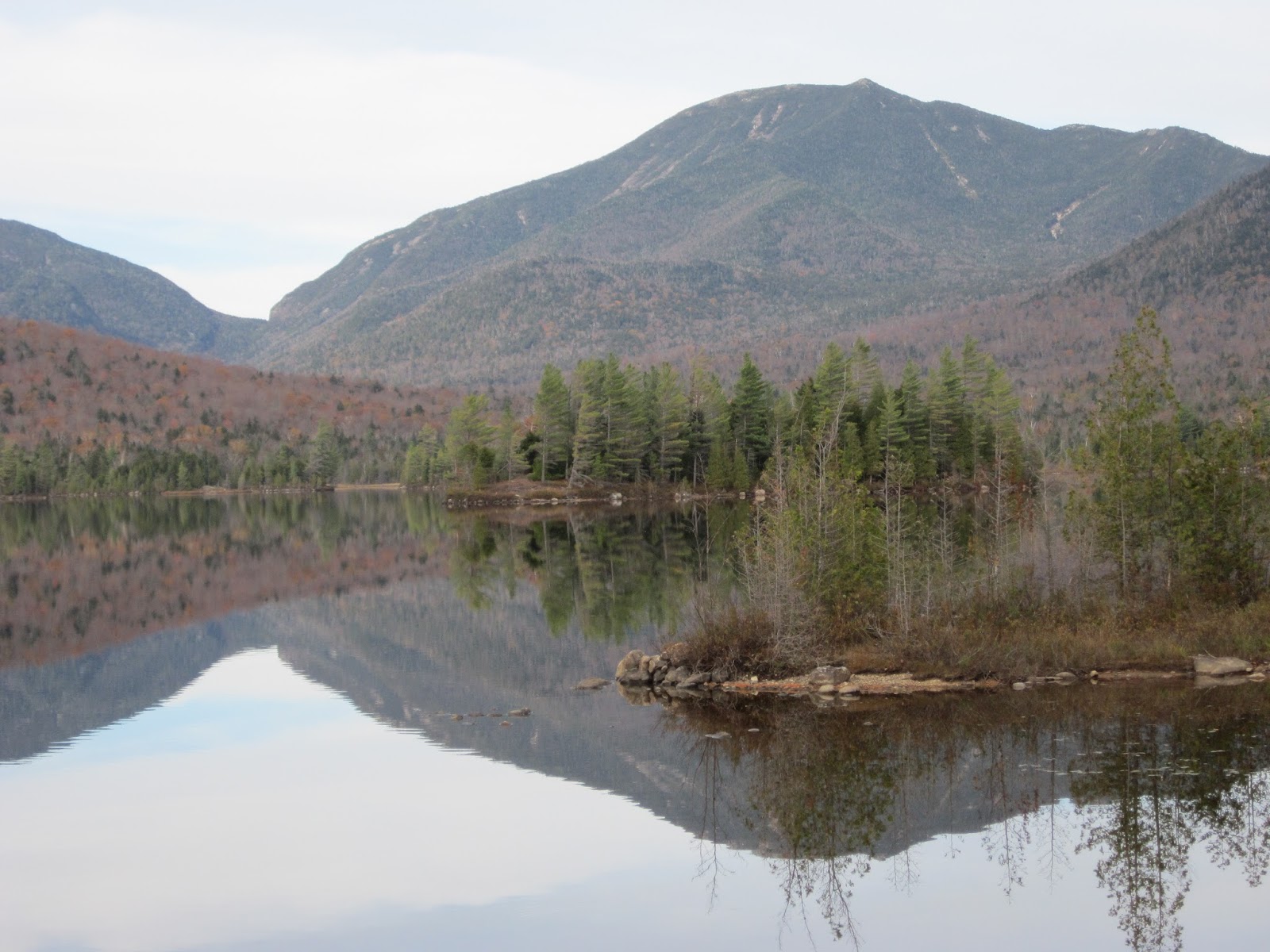
Colvin has great views. You can see the whole great range from Marcy to Lower Wolfjaw and even Giant. One of the best vantage points so far. The weather was warm and sunny at this point although only too warm when you were in direct sunlight. The temperature in the woods was pretty good for the most part.
It appeared there was a steep downhill and then a corresponding uphill to get to Blake. Bruce explained that they were both pretty much the same height so there really wasn't any elevation difference to contend with. As we went down into a saddle and back up again it turned out Bruce was right and everything was pretty much flat.
Blake does have some views which is more than I expected. After being at Colvin, and knowing we were returning there again, the views were not that impressive. The summit itself is basically in the woods. So, back to Colvin again and another break at the summit of Colvin to check out the views one more time. There is a long steep slide on Nippletop that can be viewed from Colvin. It looks like you would need ropes for that one.
On the way down from Colvin we took the Gill Brook trail which follows a stream for a while instead of heading out to the Ausable dirt road. This is a very nice trail! Gill Brook has numerous water falls and the trail follows the stream for a half mile or so. Carolyn went swimming in a pool next to a good sized waterfall. She managed to hike out without being stopped for illegal swimming on Ausable Club land!
Long day but a lot of variety and one of the nicer hikes so far.
Where are we?
Indian Head - looking at Ausable lake
Top of Colvin