Saturday, December 27, 2014

Lower Wolf Jaw - 12/27/14

It is winter but not really on this day. Below freezing at the beginning of the day but the snow got soft and the temperature probably got up to 35. There was some sun in the morning but once we got up to higher elevations it was cloudy. Unfortunately we did not have good views from the top of Lower Wolf Jaw. Mostly easy hiking in about 6-12 inches of snow although there were some icey steep slopes on the way down.


Top of Lower Wolf Jaw


Giant viewed on the way down


Sunday, September 28, 2014

Haystack, Basin, Saddleback 9/27/14

A very nice day with the weather returning to mid summer conditions. 60 degrees at elevation for most of the day and sunny. It seemed like everyone was out. The parking lot at the Garden was full when we got there at 6:30. We had never had this problem before. There is a shuttle from Marcy Field so Bruce and I went off to deal with that while Sue and Carolyn started up the trail. We made it back to the parking lot and started hiking around 7:00. The trail to John's Brook lodge is fairly smooth and easy going. We met back up with Carolyn and Sue past John's brook just as the trail started to get steeper going up toward Marcy and Haystack. We reached the junction of Marcy and Haystack fairly quickly and the sign said 1 mile and 900 feet elevation to the top of Haystack. This seemed like a very long mile as the trail went up and down little haystack and then up to the top of Haystack.
Haystack has some of the best views in the ADK's. Right next to Marcy and you can see a lot of the great range and some lesser known peaks, like Allen, that we had climbed in the past. Sunny and little wind at the top so we stopped for lunch and enjoyed the views.
The next part of the trail goes pretty far down off Haystack before starting up Basin. Not sure why the trail goes down into a hole instead of going along what looked like a nice ridge. From Haystack to Saddleback is all pretty steep and rocky. The good news with trails that go straight up is that you gain elevation fast and we reached the top of Basin fairly quickly. Basin has good views also and a nice vantage point to see the slides on Haystack.
Basin to Saddleback is very steep. Both downhill off Basin and uphill to Saddleback. Going up Saddleback there is a large area of rock that is very steep. Nothing you would want to do in November with ice on it. Today it was dry and fun to go up.
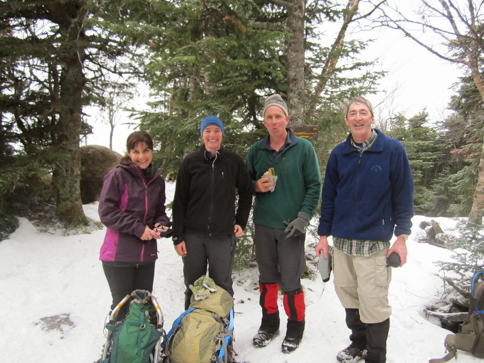
The top of Saddleback looks back toward Marcy and the trail that we had just traveled. Another nice summit and more hanging out in the sun. This was Ken's 46th peak. Bruce had hiked up with a beer which he gave to Ken to celebrate. It was a warm Mountain Brew which is a Stewart's Market specialty in the ADK's. Sue told us about purchasing it on her way to work at 8AM the previous day and the interesting looks she got waiting in line to buy it that early in the morning.
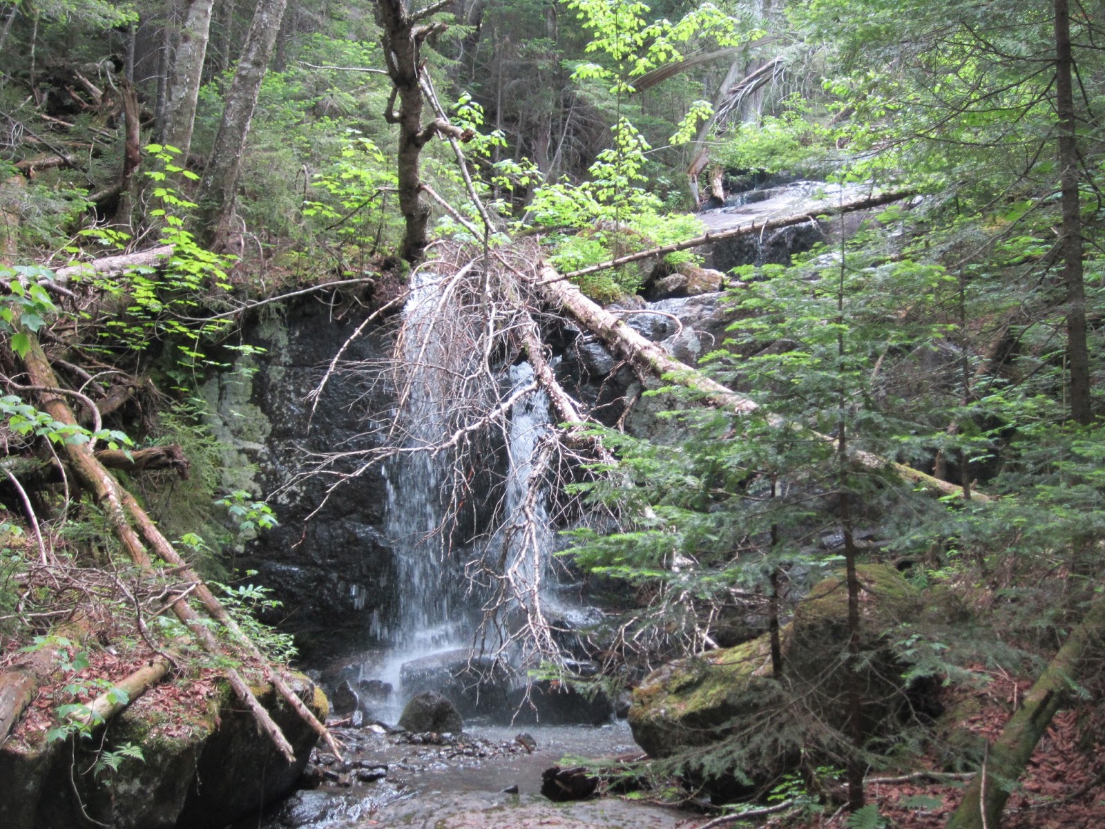
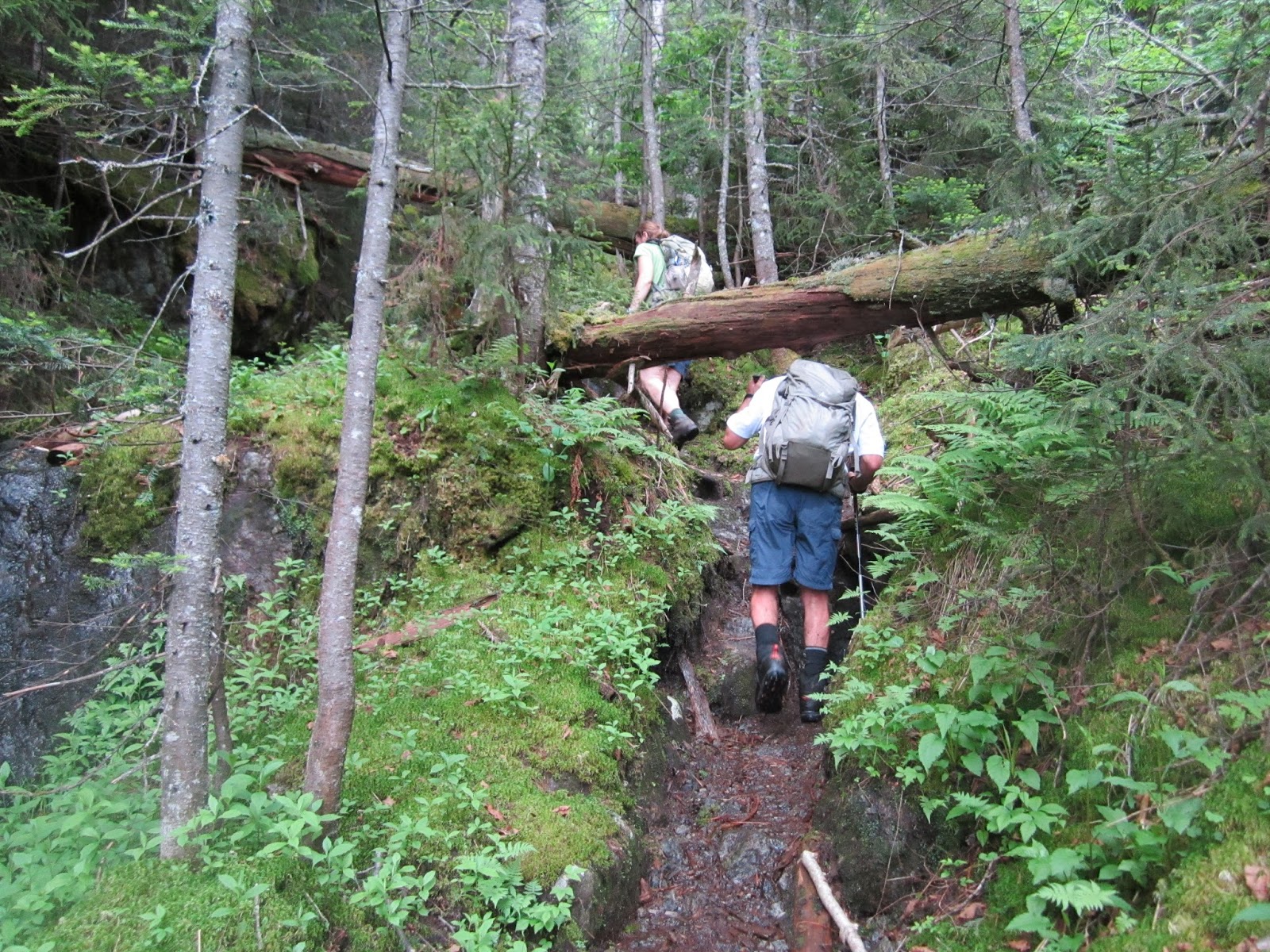
We left the top with about 6 miles still to go to get back to the car. The Ore Bed trail loses elevation fairly quickly and is fairly rough going. It gets easier as you get closer to John's Brook. The trail also goes out onto a long slide at one point.
Another nice day in the ADK's.
Group 46er count: 21 of 46


Haystack


Marcy

Basin, Saddleback, Gothics


Gothics


Trail on Saddleback


Top of Saddleback


Thursday, August 21, 2014

Seymour, Seward, Donaldson, Emmons 8/19/14

I had been thinking about this one for a little while. These mountains are some of the more remote mountains and the furthest West from my house which means a long drive. The plan was to hike Seymour and then depending on how I felt attempt to go up the Seward range. I left my house at 2:30 AM to give plenty of time to hike all 4 mountains if that worked out. I arrived at the hiking trail at 5:30 and started toward Seymour. It was cool, 40 degrees, which made for some great early morning hiking. The first half hour was in the dark. As the sun came up it stayed cool for a while since there was some fog and no direct sunlight in the woods. The trail to the start of the Seymour herd path is flat and fast going. Once you reach the herd path the trail becomes steep and muddy and has the usual trail-less scrambling over fallen trees and rocks. The steep trail gets you to the top of Seymour in a hurry. The top of Seymour has some views of the high peaks in the distance. These mountains are pretty far away from the rest of the 46ers. Seymour also has a nice rock outlook close to the top that looks over to Seward, Donaldson, and Emmons. This gives you a clear view of what would have to be done to climb all four. It didn't look easy since you have to climb down Seymour and lose most of your elevation before going up Seward. You could also see that there was a fair amount of elevation loss/gain between Seward and Donaldson. I had arrived at the top of Seymour at 8:30 AM. So far so good!
Going down Seymour took as much time as it took to go up. The downhill was tricky and there are some long stretches of steep rock that required some careful attention. Once down the herd path it was a short walk, maybe one mile, to the Seward herd path. Now I had to decide whether to attempt the other 3 mountains or not. There was plenty of time and I felt pretty good so I decided to keep going. The Seward herd path was rough and muddy, similar to Seymour, but not as steep. It was a nice trail since it followed a stream for a while with many water falls on the way up. There were some views on the way up to some of the surrounding lakes and mountains. A whole new area to what I have seen hiking the other 46ers. The top of Seward was treed and nothing special. As I started to head down Seward there were some nice views to what I think is Long Lake and the surrounding area. After the top the trail heads down and a fair amount of elevation is lost. The trail goes down to the side of the ridge and then back up to the top of Donaldson. The top of Donaldson has a rock outlook and there is another rock outlook that looks to the other side of Donaldson. I had my second lunch at one of the rock overlooks. The temperature was about 60 by this point in the day with no wind.
Emmons is a ridge walk that goes out and back from Donaldson. The ridge goes up and down a few times before you get to Emmons. By this time I had a lot of up and down. This trail was also very muddy so hard going. Emmons doesn't have much of a view so I didn't stay there long. I decided to rest a while when I got back to the top of Donaldson (2:30PM). By this point I was getting pretty tired. The plan was to return via the Calkins brook trail which goes from Donaldson back to the starting point. This trail starts a short way down Donaldson heading back toward Seward. The trail is marked by a cairn. This trail seemed to go on for a very long time. It crossed a number of streams where I re-filled my water bottles since I had a filter with me. The trail was rough at the beginning but got pretty nice as it went on and eventually turned into an easy dirt path with few rocks or obstructions. At this point it was one foot in front of the other on auto pilot. This trail eventually meets a dirt road that heads back to a point one mile into the trail I started out on. The dirt road part was maybe 2-3 miles but it seemed to take a while. Finally I reached the trail I had started on and knew I only had 1.2 miles to go. This is a pretty nice relatively smooth trail so the mile went by fast and I had made it back to the car.
A long day! About 21 miles and 4 mountains. Nice trails since it is mostly a loop so you are always looking at something new. Also a very nice area in general. There are a lot of lakes and wilderness that you looked out on from these mountains. I made it back to the car at 5:30 so it was a 12 hour day of hiking. Plus 3 hours of driving each way to get there. I will return to these mountains to hike them with the group but likely as an overnight or two day trips.
These mountains were numbers 40-43 of the 46 for me. Three more to go... Haystack, Basin, and Saddleback.

Trail start 5:30AM and 40 degrees


Moved fast to top of Seymour in cool morning air. Slowed down after this.


Seward, Donaldson, Emmons from overlook near top of Seymour


August in the ADK's


Long Lake? Seen just off top of Seward

4th mtn of day. Now back to Donaldson before heading down Calkins Brook trail


Back to trailhead. 5:30PM and 70 degrees.


Saturday, June 28, 2014

Allen - 6/28/2014

This is a hike you would probably not do unless you were climbing the 46 mountains above 4K in the ADK's. Like most of the hikes though it turned out better than anticipated. Carolyn, Sue, Bruce, and Ken set out on a clear summer day. Forecast was 85 in VT but turned out to be about 70 during the hike. Not bad but still hot for hiking. The hike is 18.5 miles and some of the terrain is pretty rough. It is like climbing Camels Hump except that you hike 7 miles in to the mountain first and then instead of a nice wide hiking trail you get a very steep herd path that goes up a water fall with branches and fallen trees all over. The climbing really starts at Allen falls. One of the many water falls in the river that you walk up and to the side of as you go up the mountain. When we got to Allen Falls we thought we had another half hour to the top. Not so. Our pace slowed way down as we made our way over all types of obstacles and it took another 1.5 hours to make it to the top. There was a certain type of moss or slime on about half of the rocks near/in the river. This was like black ice. Carolyn took one good fall in the river and everyone had a good scare or two as your feet zipped out from under you. The top of Allen is a treed small clearing and for some reason had a number of deer flies which were not a problem up to this point. Luckily there is a short path off the top that leads to a nice Easterly view of Marcy, Skylight, Dix, and a number of other mountains in the great range. This also had a great view of Panther gorge which is a trip that Sue has on her mind.
Surprisingly there were 3-4 other groups of people going up this mountain. About half were not up to the task. We ran into one person who looked like they had reached their limits about half way up the mountain and about 8 miles into the woods. I am sure they didn't make it out until after dark and I doubt very much they had lights or enough water. Another woman had been hiking in at a very slow pace. She was in better shape but again probably didn't get out in the light. We also ran into a woman who said this was her first ADK hike. Her boy friend will likely never see her again and certainly will never be allowed to choose a destination for a date again.
The trail was very muddy in a number of areas. I will let the pictures tell that story. There is one water crossing where you need to take your boots off. Nice cool water that we ended up hanging out in on the way back. Felt very good to stand/sit in the water and helped a lot to get motivated to do the last 4 miles from the river back to the parking lot.
This hike was tough mainly because it was just long. We started driving in VT at 5:30AM. Started hiking at 8 and got back to the car at 6:30. Home by 9:30. Long day! Had dinner at a creamy stand on the way back. Food was great! Although anything and everything tastes great after 10 hours of hiking. Even Bruce's questionable hot dog with "meat" sauce and onions looked really good.


Allen Falls - Steep, rough after this

Bruce heading to the yacht club


Thinking about another 9 miles...

Views a short walk East of the top


This is the trail